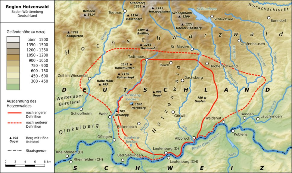
Karte der Region Hotzenwald im südlichen Schwarzwald (Map of the Hotzenwald region in southern Black Forest, Germany). Map by Thoroe (Thomas Römer)/OpenStreetMap data [CC-BY-SA-2.0 (http://creativecommons.org/licenses/by-sa/2.0)]. Available from Wikimedia Commons.
The Hotzenwald is the southernmost part of the Black Forest. This map shows the Hotzenwald region and the elevation (in meters) of the land in and around the area. It includes information about mountains and their height.
My great-great-grandfather John Gersbacher (Johann Gerspacher) was from Görwihl, which is located in the Hotzenwald and is shown on this map. My great-great-grandmother Kunigunde Dreier was from nearby Niederwihl; the couple lived there before immigrating to the United States, and their German-born children were born there. Niederwihl became part of Görwihl in 1975.


No comments:
Post a Comment