Covering genealogy, family history, historical events and places, and anything else related!
Monday, September 21, 2015
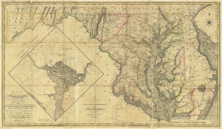
Mappy Monday: Maryland and Delaware, 1794
Griffith, Dennis; Thackara, James; and Vallance, John. Map of the State of Maryland laid down from an actual survey of all the
principal waters, public roads, and divisions of the counties therein;
describing the situation of the cities, towns, villages, houses of
worship and other public buildings, furnaces, forges, mills, and other
remarkable places; and of the Federal Territory; as also a sketch of the
State of Delaware shewing the probable connexion of the Chesapeake and
Delaware Bays. Philadalphia: J. Vallance, 1794. Library of Congress, Geography and Map Division.

No comments:
Post a Comment