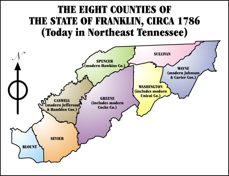
The State of Franklin, 1784-1790. By Iamvered [GFDL (www.gnu.org/copyleft/fdl.html) or CC-BY-SA-3.0 (http://creativecommons.org/licenses/by-sa/3.0/)]. Available from Wikimedia Commons.
This map shows the eight counties of the state of Franklin: Blount, Caswell, Greene, Sevier, Spencer, Sullivan, Washington, and Wayne. The area is now northeast Tennessee and consists of the following counties: Blount, Carter, Cocke, Greene, Hamblen, Hawkins, Jefferson, Johnson, Sevier, Sullivan, Unicoi, and Washington.


No comments:
Post a Comment