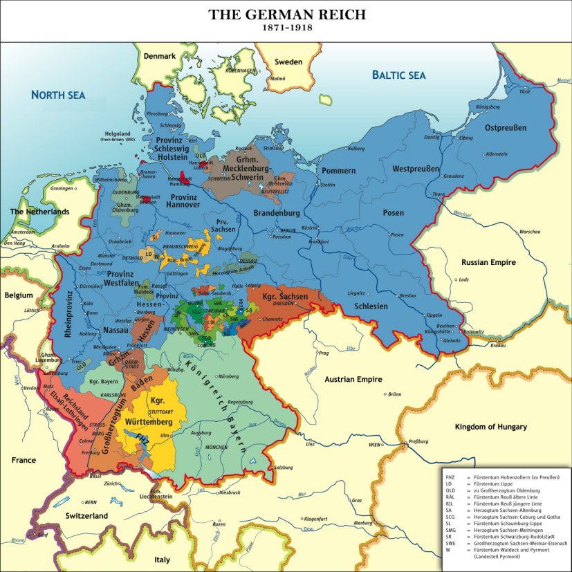
Map of the German Reich 1871–1918. Derivative work by Wiggy!, based on Deutsches_Reich1.png by Ziegelbrenner [CC BY-SA 2.5-2.0-1.0 (http://creativecommons.org/licenses/by-sa/2.5-2.0-1.0), GFDL (http://www.gnu.org/copyleft/fdl.html) or CC-BY-SA-3.0 (http://creativecommons.org/licenses/by-sa/3.0/)], Available from Wikimedia Commons.
This map shows the German Empire from 1871-1918. The FamilySearch Catalog uses these jurisdictions, so it is important to know these boundaries if you are researching German ancestors.


No comments:
Post a Comment