Covering genealogy, family history, historical events and places, and anything else related!

Sunday, October 30, 2016

Sunday's Obituary: John G. Gatlin

Nashville American, 1 September 1897, page 3

John J. Gatlin, a well-known brickmason, died last night at the residence of his sister, Mrs. N. L. Page, 95 Wharf avenue. He was 56 years old and had lived the greater part of his life in this city. He leaves a wife.

John G. Gatlin was born on 15 August 1841 in Tennessee. He was the son of my 4th-great-grandparents John McNairy Gatlin and Margaret "Peggy" Gower. He served in the Confedederate Army as a private in the 10th Regiment, Tennessee Cavalry, Company D, and was held at Rock Island Barracks as a prisoner of war. He married Martha Ann Gower on 20 December 1865 in Davidson County, Tennessee. In 1874, John and Martha adopted a two-year-old girl, Minnie (formerly Tennessee Reed). John died on 31 August 1897 in Nashville, Davidson County, Tennessee and was buried in Mount Olivet Cemetery, Nashville.

Saturday, October 29, 2016

Superstorm Sandy

Four years ago today, Superstorm Sandy slammed into the United States. The storm made landfall near Brigantine, New Jersey on 29 October 2012, as a post-tropical cyclone. The storm's winds reached 90 mph near Staten Island, New York. It was the deadliest and most destructive hurricane of 2012, and the second most costly hurricane in United States history.

More than two million households in New Jersey lost power. 37 people were killed, and 346,000 homes were damaged or destroyed. The Jersey Shore suffered the most damage. Much of the state experienced flooding.

Before the storm hit, I was very worried about flooding, because much of the town I live in is in a flood zone. Although I did not live in the flood zone, I would still be affected by flooding, because the roads that I would need to take to get to the highways would be closed, and it would be difficult for me to get to work.

My power went out on the night of 29 October 2012. The next day, I was amazed to find out that there was no flooding in my town, but there were many downed trees. Because the whole area had no power, the college where I worked was closed. I had no heat. Thankfully, I at least had hot water. I slept on the couch because I thought it would help to conserve heat if I huddled in a smaller space. My cats Jewel and Harmony stayed close to me. The town community center had a generator, and I went there during the day to keep warm and to charge my cell phone.

I was without power or heat for nearly eleven days. Some areas had their power restored earlier. I went shopping and bought wool socks and long underwear. After the college library where I worked reopened, I stayed at work late, until closing time. I went to the back room after my work day was over, and I used the computer and heated up canned food in the microwave. On my last night without power, there were snow flurries. When I got home from work the next day, I found that my power had finally been restored.

References
Blake, Eric S; Kimberlain, Todd B; Berg, Robert J; Cangialosi, John P; and Beven, John L. Tropical Cyclone Report: Hurricane Sandy (AL 182012) 22-29 October 2 012. National Hurricane Center.
Effects of Hurricane Sandy in New Jersey 
Hurricane Sandy

Friday, October 28, 2016

Gateway Arch, St. Louis, Missouri


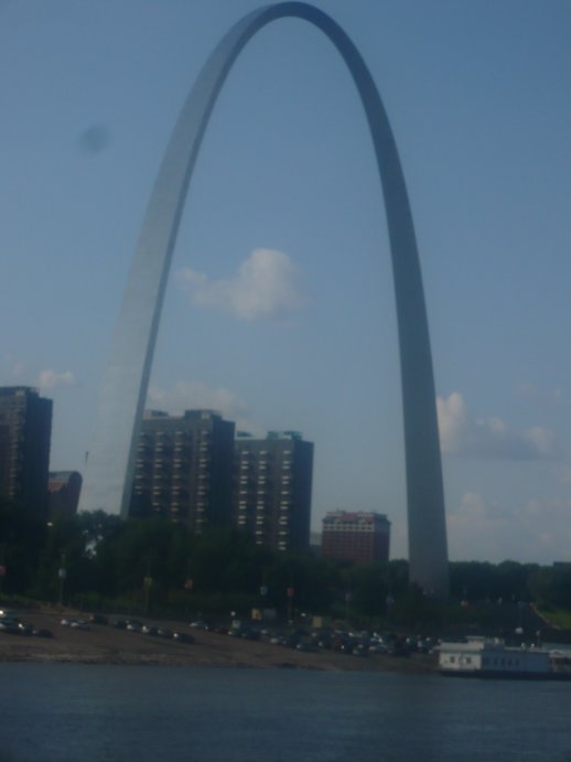
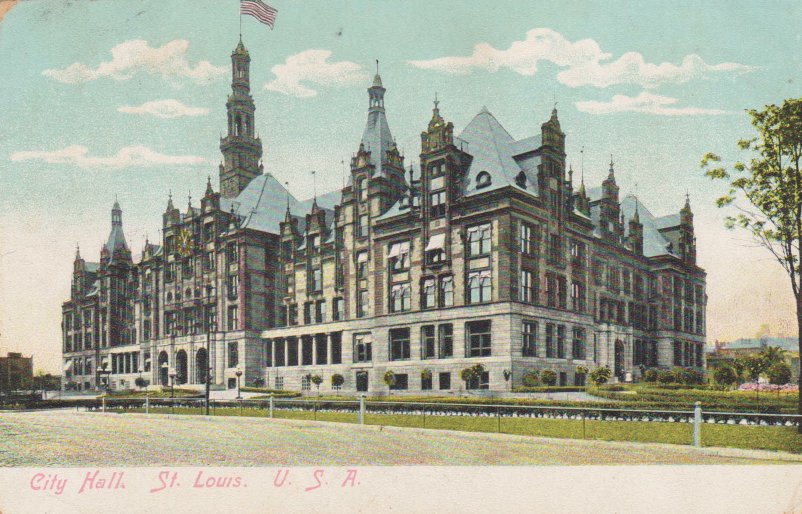
The Gateway Arch in St. Louis, Missouri is the world's tallest arch and the tallest man-made monument in the Western hemisphere. It is 630 feet tall. Its facade is made of stainless steel. From the top of the arch, it is possible to see up to thirty miles in each direction.

In 1933, civic leader Luther Ely Smith came up with the idea to build a memorial on the Mississippi River riverfront in St. Louis. As a result, the Jefferson National Expansion Memorial Association was created. In 1945, a design competition for the memorial was announced. The contest opened on 30 May 1947, and the winning design, by Finnish-American architect Eero Saarinen, was chosen on 18 February 1948.

The monument's construction began on 12 February 1963. It was completed on 28 October 1965.

References
About the Gateway Arch
Gateway Arch 
History of the Gateway Arch

Thursday, October 27, 2016

Those Places Thursday: Vaughn's Gap, Davidson County, Tennessee


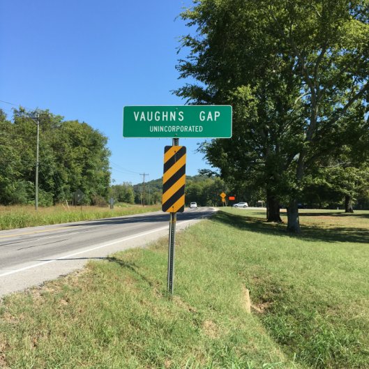
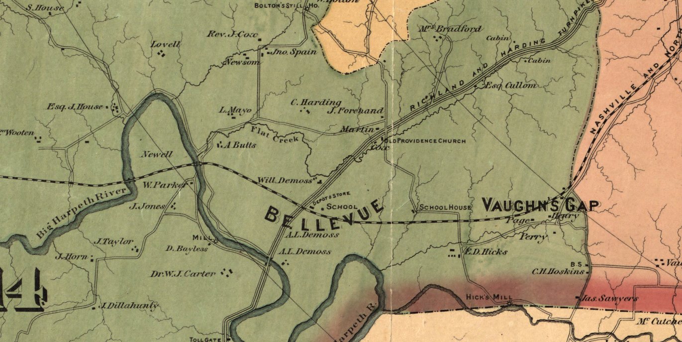
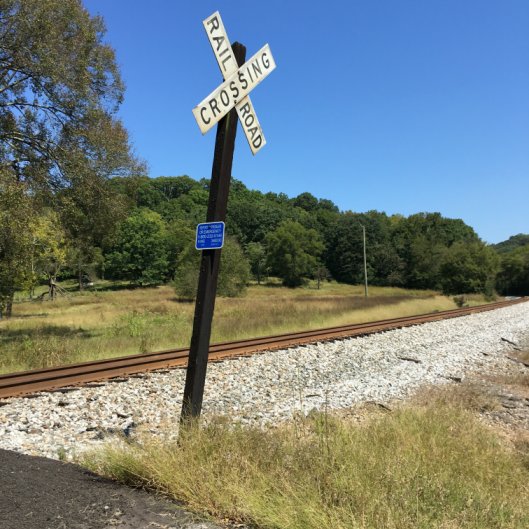
Vaughn's Gap is located in southwestern Davidson County, Tennessee, near the Williamson County border. Edwin Warner Park is located in this area.

Excerpt from Foster, Wilbur F. Map of Davidson County Tennessee, from actual surveys made by order of the county court of Davidson County, 1871. New York : G.W. & C.B. Colton & Col., 1871. Available from Library of Congress.

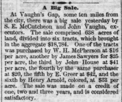
James Sawyer (or Sawyers), who I believe to be my 4th-great-grandfather, purchased land at Vaughn's Gap on 9 November 1871.

Nashville Union and American, 10 November 1871, page 4

My 2nd-great-grandfather James William Tarkington lived with James Sawyer and his wife Louisa (McDowell) Sawyer. After James William Tarkington married my 2nd-great-grandmother Anna Malvina Binkley, the couple lived with the Sawyers in Vaughn's Gap in the 14th District of Davidson County. They later lived in Vaughn's Gap the 11th District of Davidson County with their children, including my great-grandmother Anna Gertrude Tarkington. Anna Malvina Binkley's brother James Rutherford Binkley and his wife Clementine Virginia "Jennie" (Leech) Binkley, and their children also lived in Vaughn's Gap. James and Jennie both served as postmasters. Jennie was also the ticket agent for the Nashville, Chattanooga & St. Louis Railway. The Binkley residence was in the same building as the post office and ticket office.


Members of my family are buried in the J. R. Binkley Cemetery, Vaughn's Gap.

I am working on a one-place study of Vaughn's Gap. It is a sub-project of the Davidson County, Tennessee One-Place-Study.

Tuesday, October 25, 2016

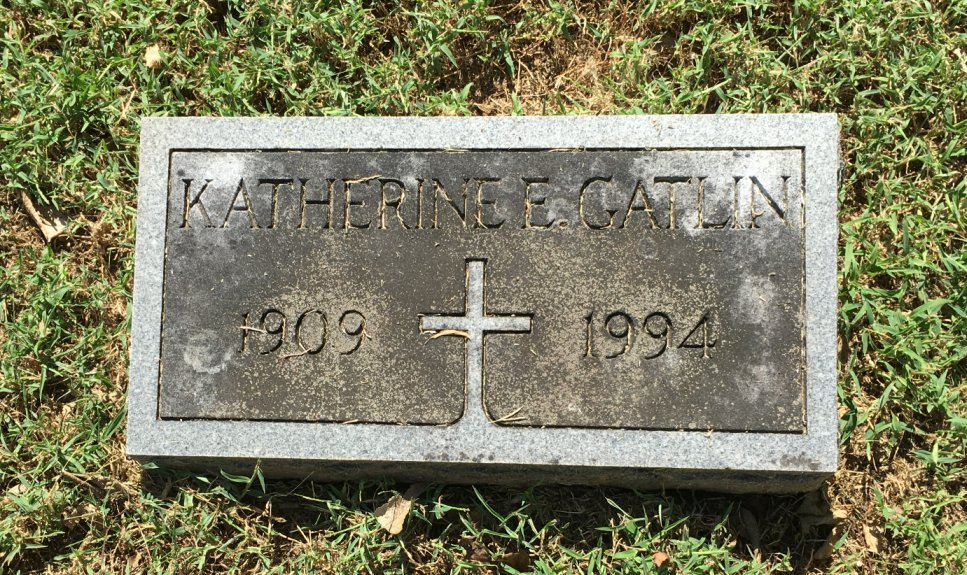
Tombstone Tuesday: Katherine Elizabeth Gatlin


Katherine Elizabeth Gatlin was born in Nashville, Davidson County, Tennessee on 16 November 1909. She was the daughter of Clarence Bateman Gatlin and Ella Lee. She worked for AT&T for forty-one years. She died on 18 June 1994 in Kettering, Montgomery County, Ohio and was buried on 21 June 1994 in Calvary Cemetery, Nashville, section 16, lot 64, space 7.

Monday, October 24, 2016

Mappy Monday: Bass Islands, Lake Erie

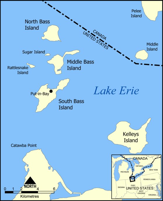
Map of the Bass Islands in Lake Erie. By NormanEinstein CC BY-SA 3.0 (http://creativecommons.org/licenses/by-sa/3.0). Available from Wikimedia Commons.

This map shows the location of the Bass Islands, which are in the western half of Lake Erie, and are part of Ottawa County, Ohio.

My 5th-great-grandfather Andrew Russell was a private in Tunstall Quarles' Company of Infantry, 2nd Regiment Kentucky Volunteer Militia during the War of 1812. His regiment formed on 1 September 1812. By mid-September, they reached General William Henry Harrison's headquarters in St. Marys, Ohio. They then proceeded north and began the construction of Fort Jennings. After the fort was completed, the regiment remained on garrison duty for a few months. They then headed north to Put-in-Bay, which is located on South Bass Island. The U.S. had suffered defeats in and near the western Lake Erie area at the beginning of the war. Andrew's regiment may have been sent north to help increase the U.S. military presence in the area. They were eventually sent back to Cincinnati because their term of service was coming to an end. I am not sure how much time Andrew spent in Put-in-Bay. South Bass Island has been called the "Key West of Lake Erie," but surely it did not seem that way to Andrew and the other men during the winter of 1813.