
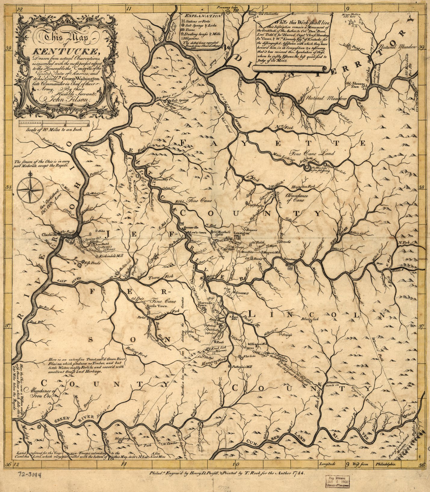
This 1784 map by John Filson is the first known map of Kentucky. Filson dedicated the map to the United States Congress and to George Washington.
My Hardgrave ancestors came to Lincoln County, Kentucky around 1795. My 5th-great-grandparents Hannah Hardgrave and Andrew Russell married in Lincoln County in 1799, and afterward lived in Pulaski County, which was created out of Lincoln and Green Counties.
No comments:
Post a Comment