
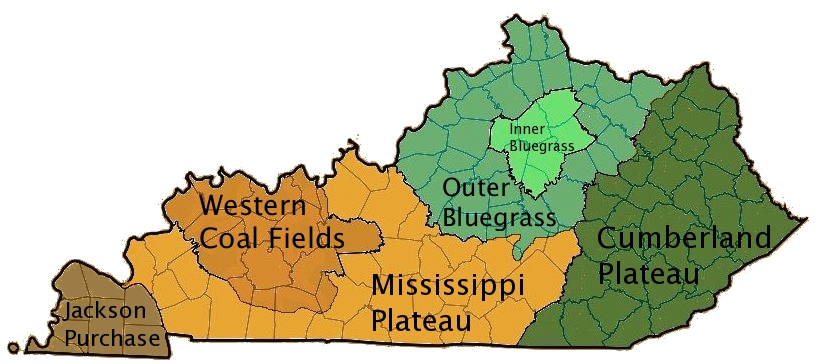
This map shows the different physical geographic regions of Kentucky:
Cumberland Plateau: includes the Eastern Kentucky Coal Fields; the eastern portion consists of escarpment formed from sandstone and other sedimentary rocks, and the interior has forested hills and valleys
Mississippi Plateau or Pennyroyal Region: a limestone plain with sink holes, sinking streams, springs, valleys, and caverns
Outer Bluegrass: deep valleys, very little flat land
Inner Bluegrass: fertile soil and rolling hills with sink holes, sinking streams, springs, and caves
Western Coal Fields: part of the Illinois Basin (also called Eastern Interior Basin); escarpment formed from sandstone and other sedimentary rocks
Jackson Purchase or Mississippi Embayment: flat land with lakes, ponds, and swamps
No comments:
Post a Comment